Attack of the Buns is a 320km
Attack of …what?
If you have never heard of this bike ride, Attack of The Buns is a route developed by Adam Lee of endlesscycle.com.au, which has won him the Grand Prize on Bikepacking.com for the Rout3 challenge. It snakes its way between the “Buns” in Southern Tablelands – Bungendore to Bundanoon – through some spectacular scenery and remote trails in Morton National Park. Surrounding scenic areas of Tallaganda forest, and some of the popular destinations in the south-east New South Wales – Nowra and Kangaroo Valley – are thrown in for good measure. The route is 320km long and is meant as a long weekend ride.
Our version: Touring of the Buns
We do like a good off-road bike tour but are no ultralight bikepackers, nor endurance racers who only start grinning after 100+kms a day. So the version of the Attack of The Buns route presented here is a bit more relaxed touring version, spread to four days of riding. If you have never been to this area, or travel from afar, you might even add extra time. A day or two to hire a canoe and explore the Shoalhaven River from Kangaroo Valley would make for a nice change after a few days on a bike.
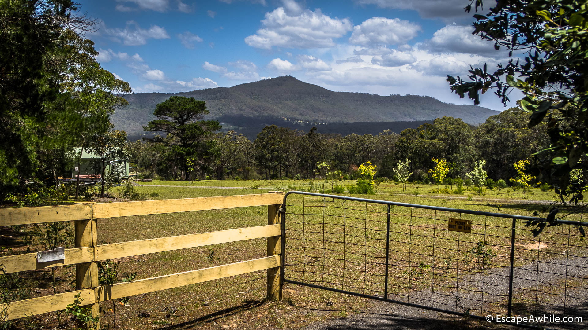
Based in Canberra, we have decided to ride in the opposite direction, from Bundanoon to Bungendore. That way, we could get to Bundanoon from Canberra on the evening train after work. Further, this made the pick-up drive much shorter for my wife, who was kind to collect us from Bungendore after the ride. Last, but not least, riding the 450m vertical drop from the Bundanoon plateau down on the first day, rather than up on the last, certainly was a bonus.
Day 0: Train ride to Bundanoon (2km)
We ride our fully loaded bikes to work and meet at the train station hour and a half before the train departs. Giving ourselves over an hour to dismantle the bikes and pack them into the boxes was a suggestion from the friendly station staff.
To our surprise, bike boxes provided by the railways are much smaller than the ones at the airport. The time flies, and after well over an hour of trying to wrestle the fat tyres and large frame into the box we give up. Frame and a single wheel, with few of the smaller bags fit inside the box and the 20kg limit. The rest of the bags, plus a wheel each, we end up carrying as luggage onto the train.


At Bundanoon, boxed bikes await us at the platform. We re-assemble the bikes and leave the boxes at the station – they will be picked up by the next train crew and reused. Apart from the pain of dismantling and re-building the bikes, the $12 to transport your bike on the train, including the box hire, is a sweet deal.
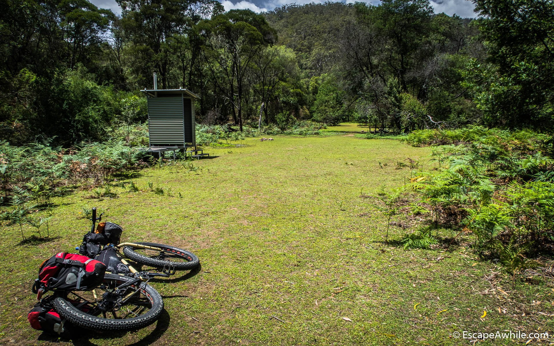
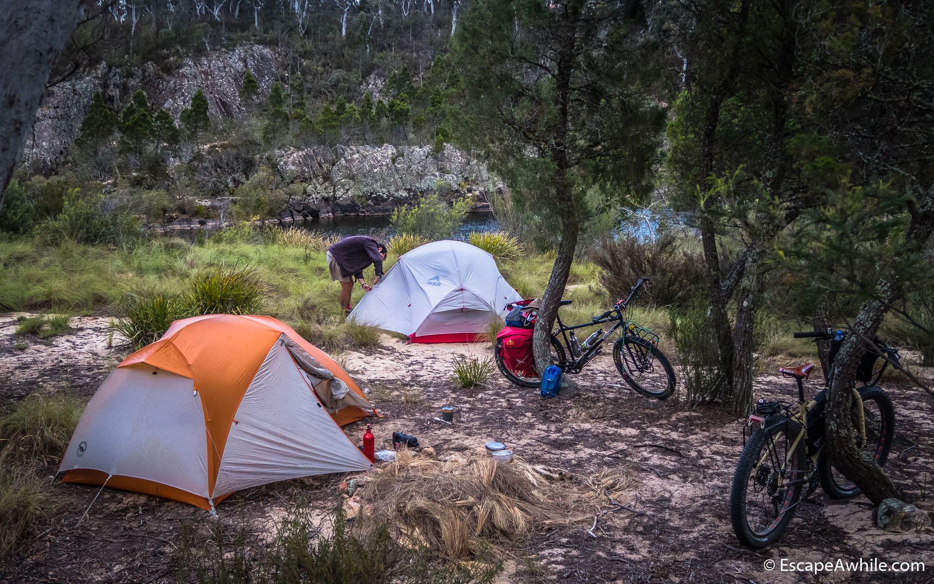
Already after dark, we ride a short 2km to Gambell’s Rest campground for the night. Hint if you want to stay there: your booking form will have many different numbers, one of them will be the PIN code for the toilets and showers. Make sure you know that one or suffer the consequences!
Day 1: Bundanoon to Nowra (90 km)
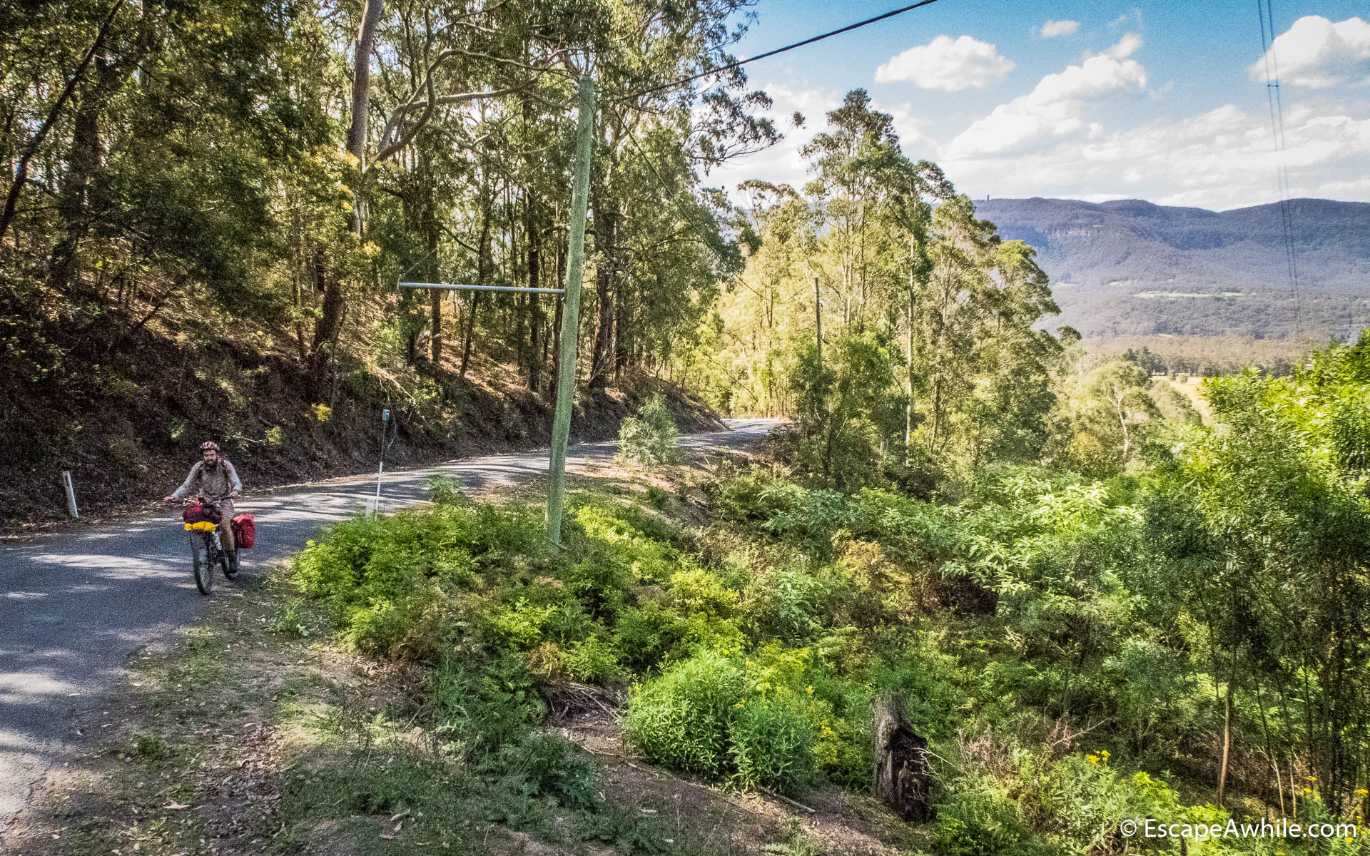
In the morning, we quickly stop at Jumping Rock cafe in Bundanoon for a morning coffee. After that, we are on our way. The ride starts on the main Bundanoon-Exeter road. But with every turn, we hit smaller and less trafficked roads. Soon we are on the dirt, and after 24 km we turn off to the first 4WD trail – Gunrock Creek fire trail.

There are a few fun challenges to start the day – some rock climbing, and occasional ruts filled with muddy water deep enough to swim in. But mostly this is a pleasantly flat ride through blooming bushland.

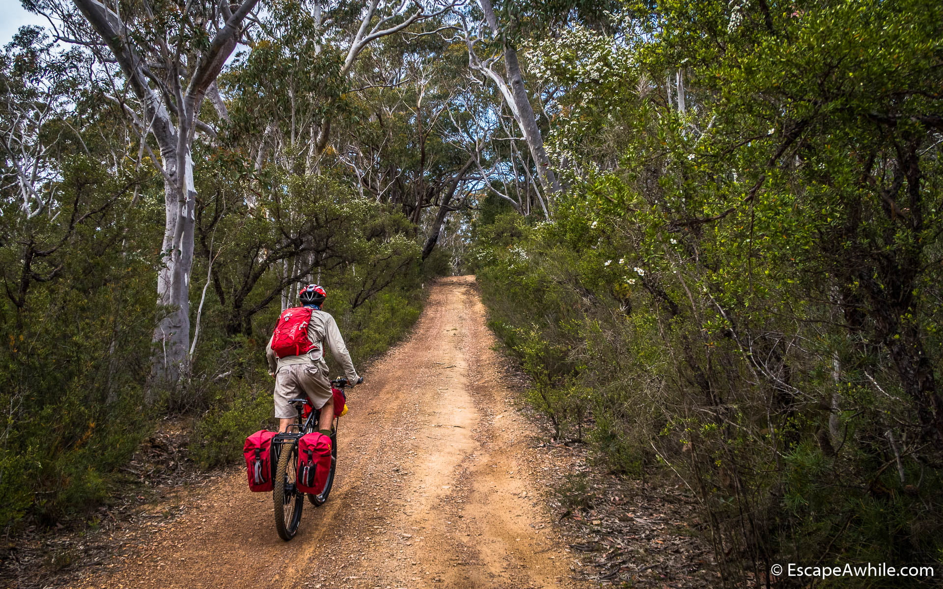
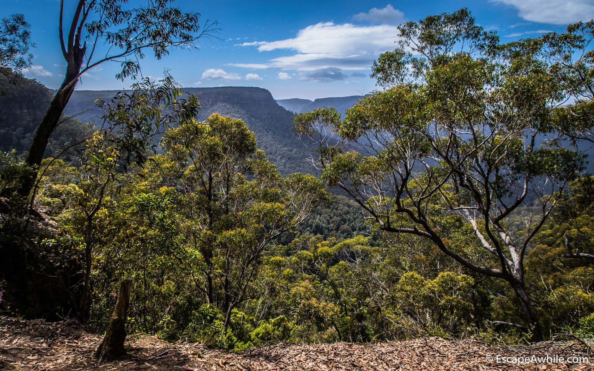
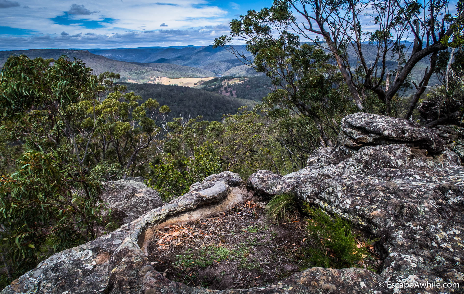
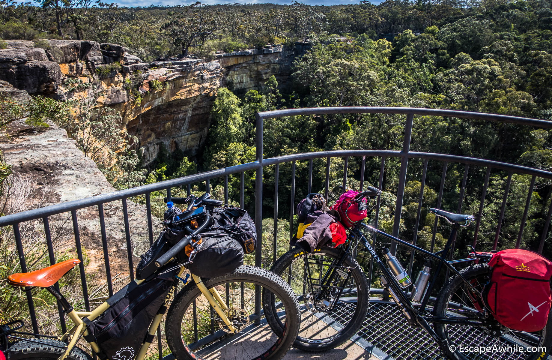
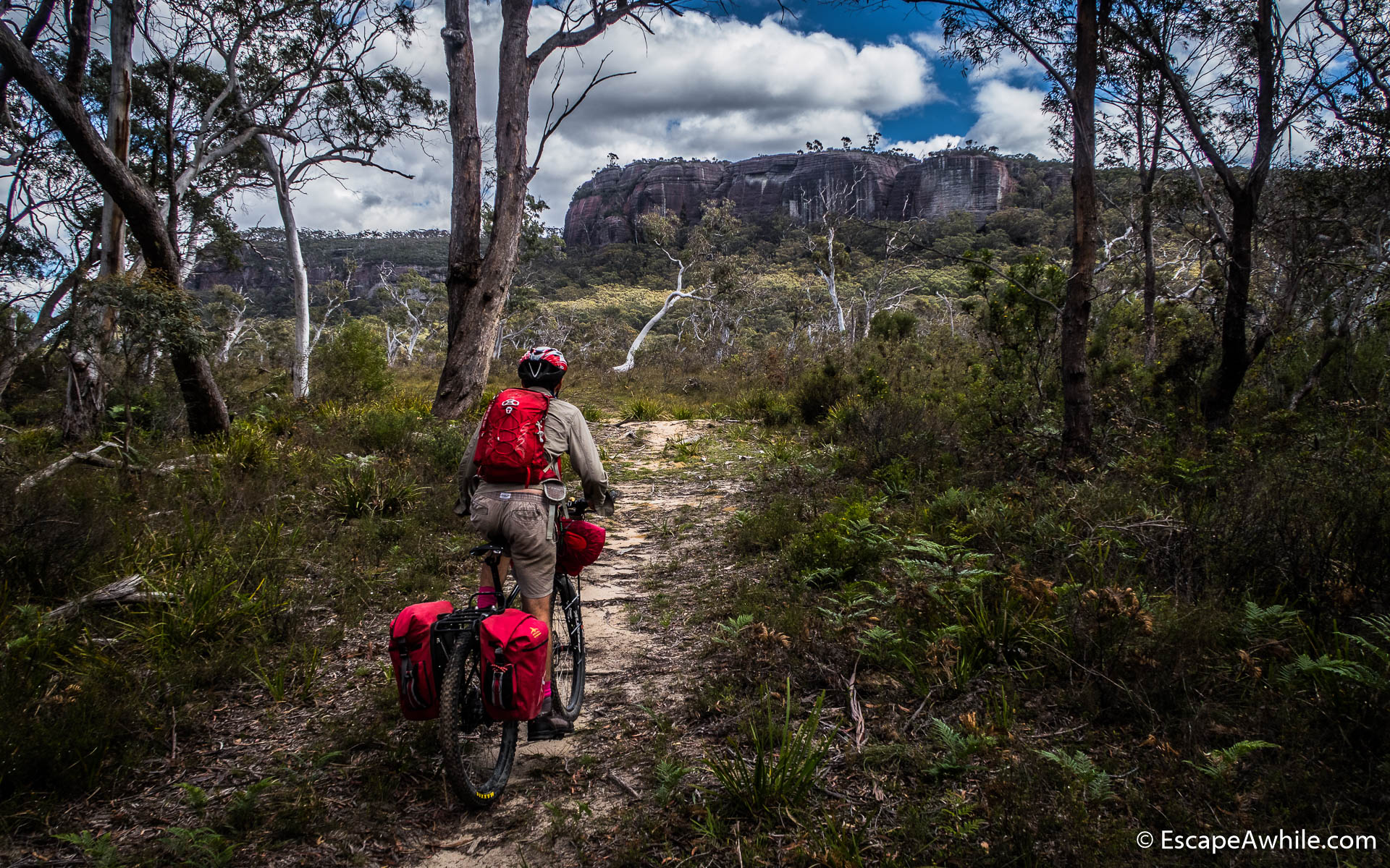
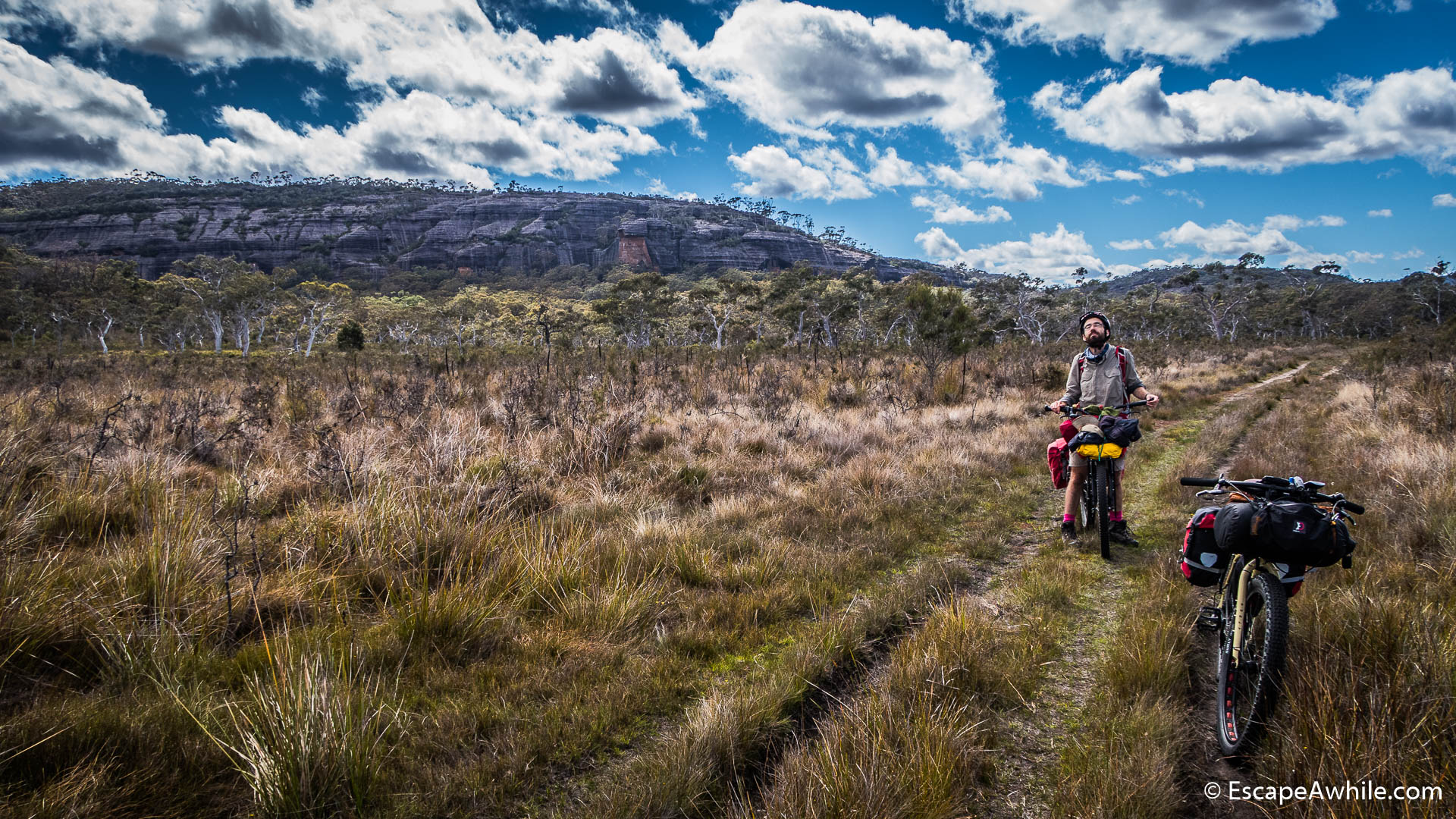
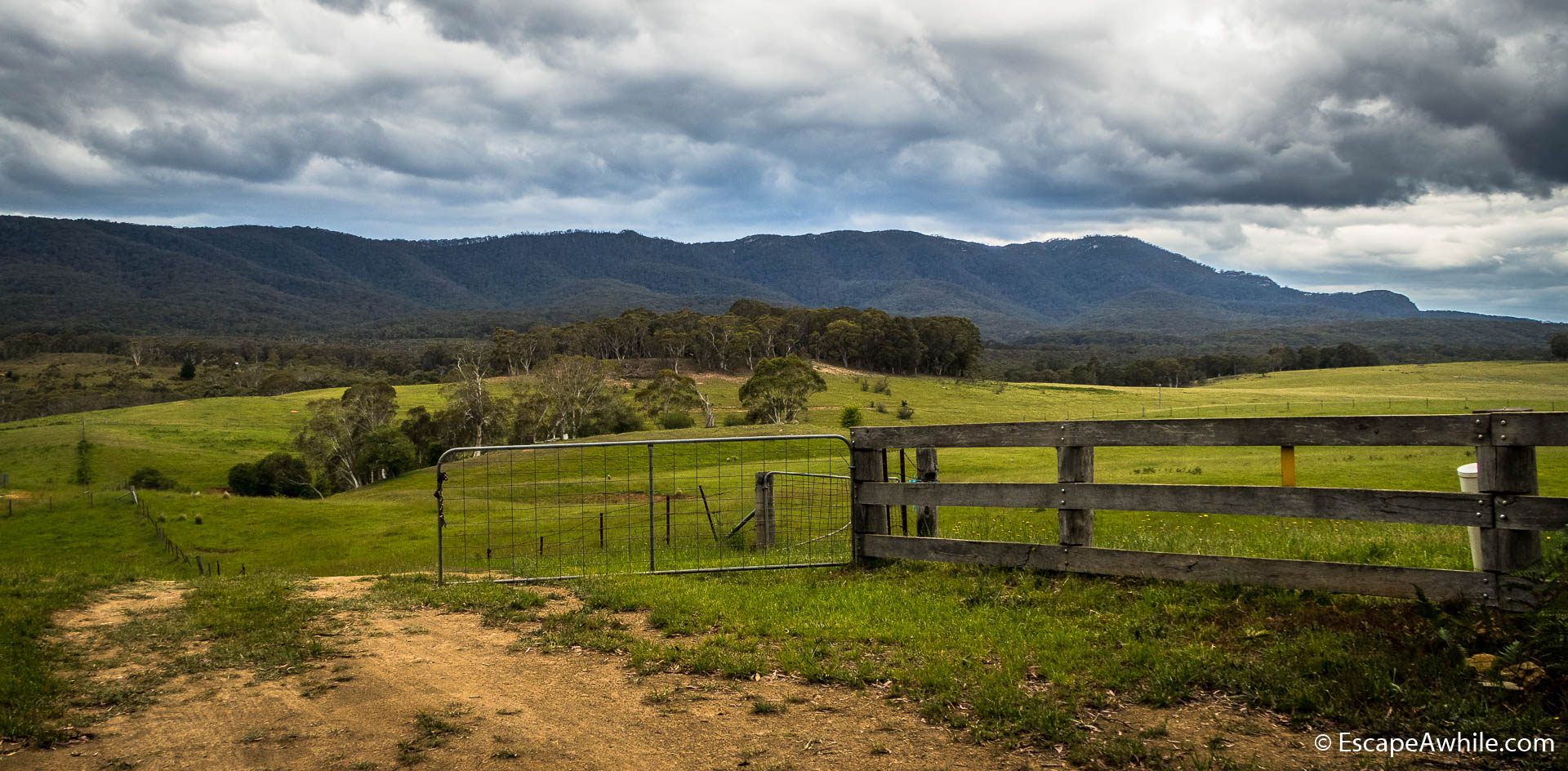
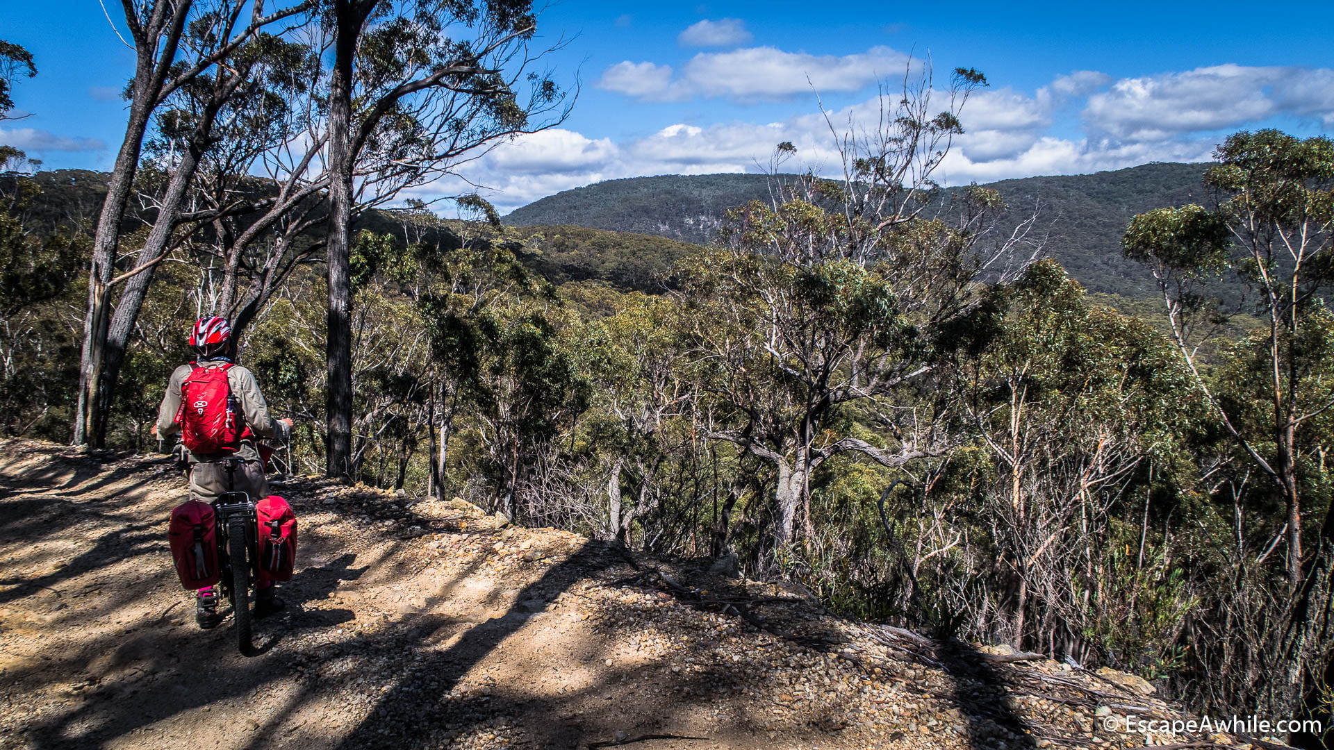
Soon we join to the Meryla fire trail, followed by the turn to the Wombat Hill Lookout trail. Both trails follow the edge of the plateau. In several places, we get views over Morton wilderness down in the valley, where we will drop shortly.


Into the wilderness
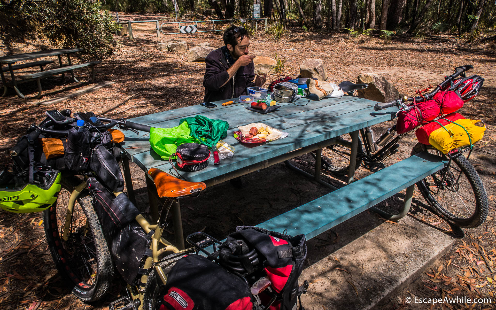
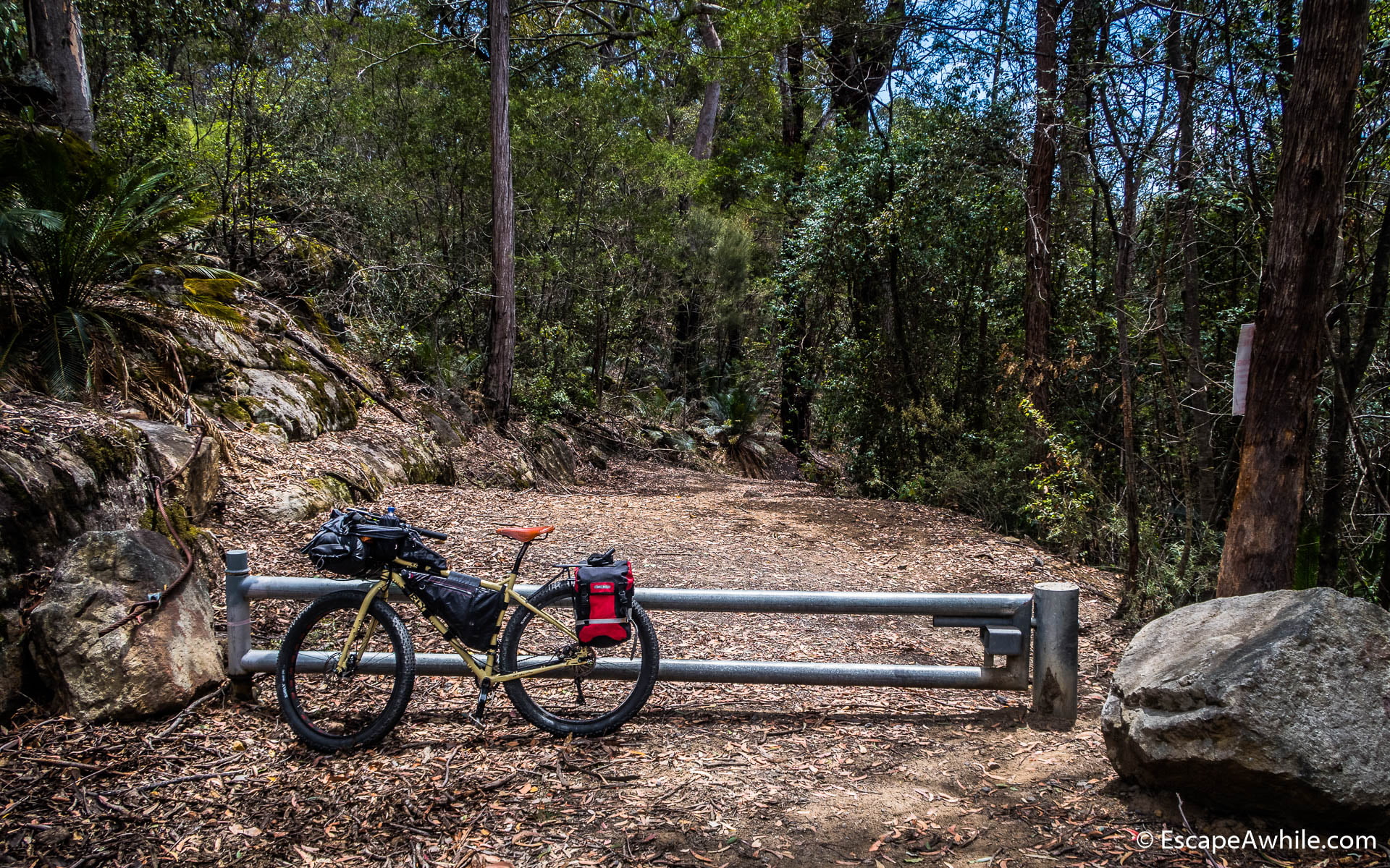
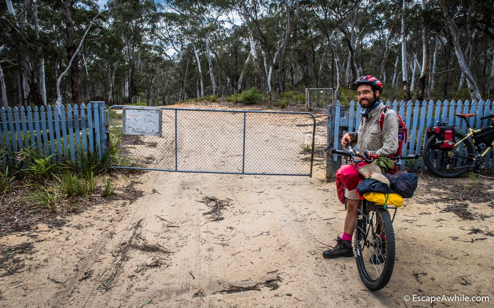
At the crossroads of Wombat Hill trail and Griffiths trail, there are locked gates blocking vehicle access to the Morton wilderness. We have lunch at a small picnic area. After lunch we conquer not one, but two sets of locked gates at the start of the Griffiths trail. Particularly the second gate is built properly, and the only way through it is to lift the loaded bikes over the gate.

Down to the valley
The following four kilometres are an enjoyable downhill ride, dropping 450 vertical meters on a zig-zagging fire trail to Yarrunga Creek. This is one of the times, where we are glad we chose the reverse direction for the ride. The drop of 450 meters, followed by the 250 vertical meters climb on the first day seems to be easier than the reverse on the last day of the ride.
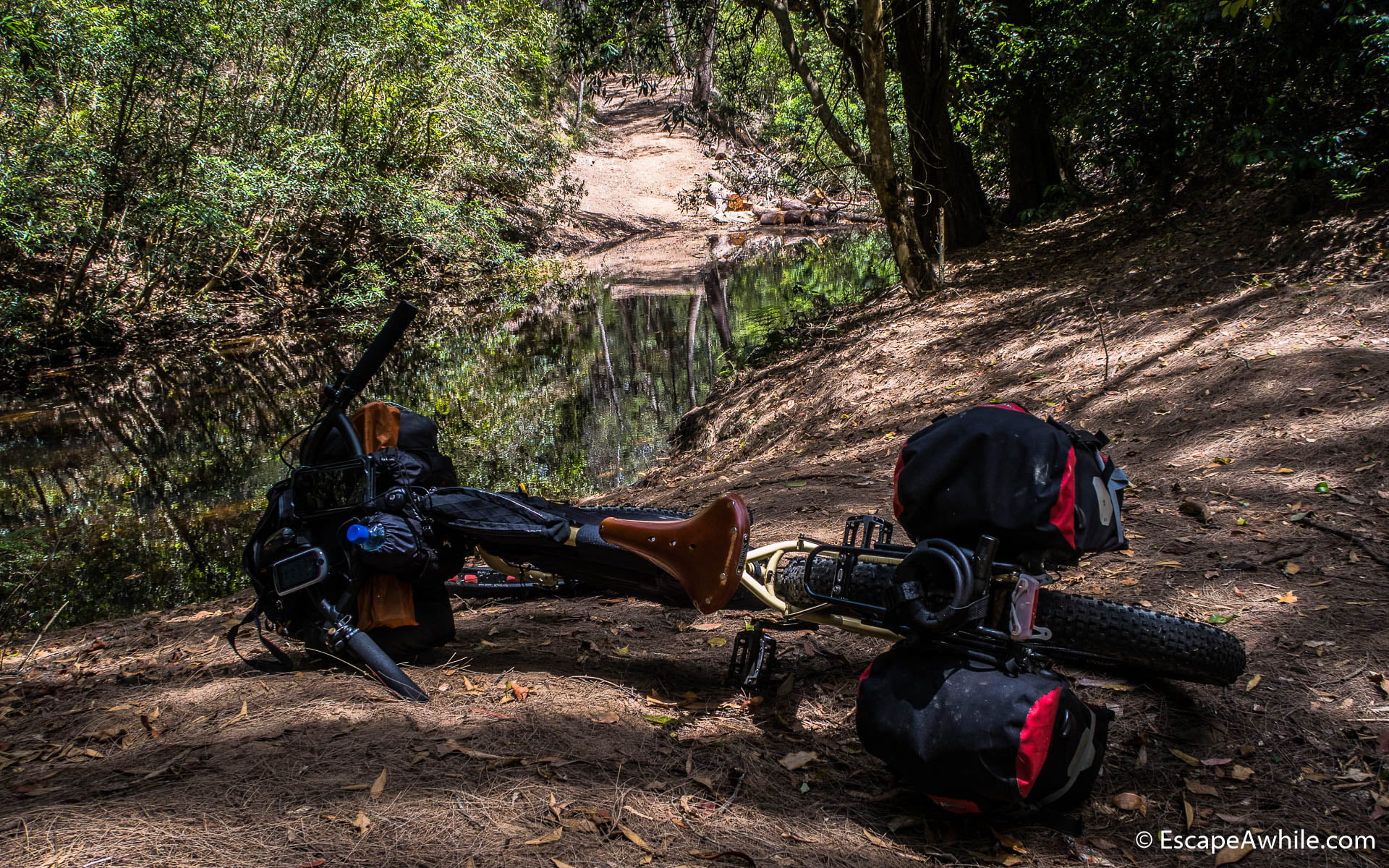
There are few places with scenic views along the way. Once at the bottom, the trail follows Yarrynga Creek. Soon we arrive at a pleasant Griffins farm campsite – a nice grassy flat area along the creek, complete with the toilets. This would be my choice for the last night if doing the ride in the opposite direction as posted on bikepacking.com.


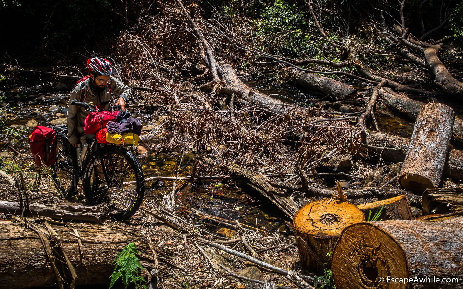
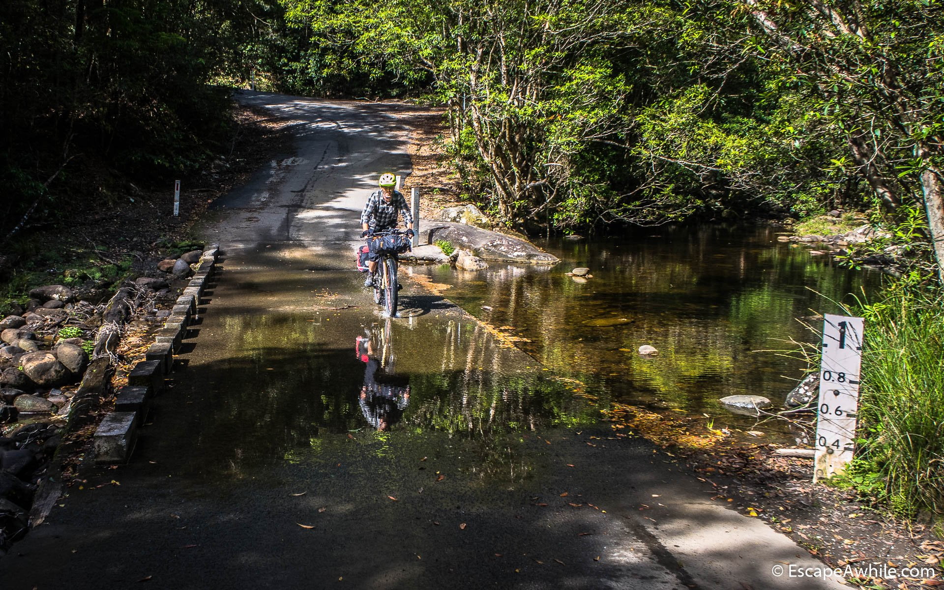
Few excitements await along the Yarrynga Creek to break the enjoyable ride. The first one is a fallen tree, which fortunately we can sneak under. The next challenge is crossing the creek itself. While the ford at the trail crossing seems a bit deep, there is a shallow crossing with step stones just 30 meters up the stream. If you can get your bike to it through the bush and fallen trees, that is!


Up the hill
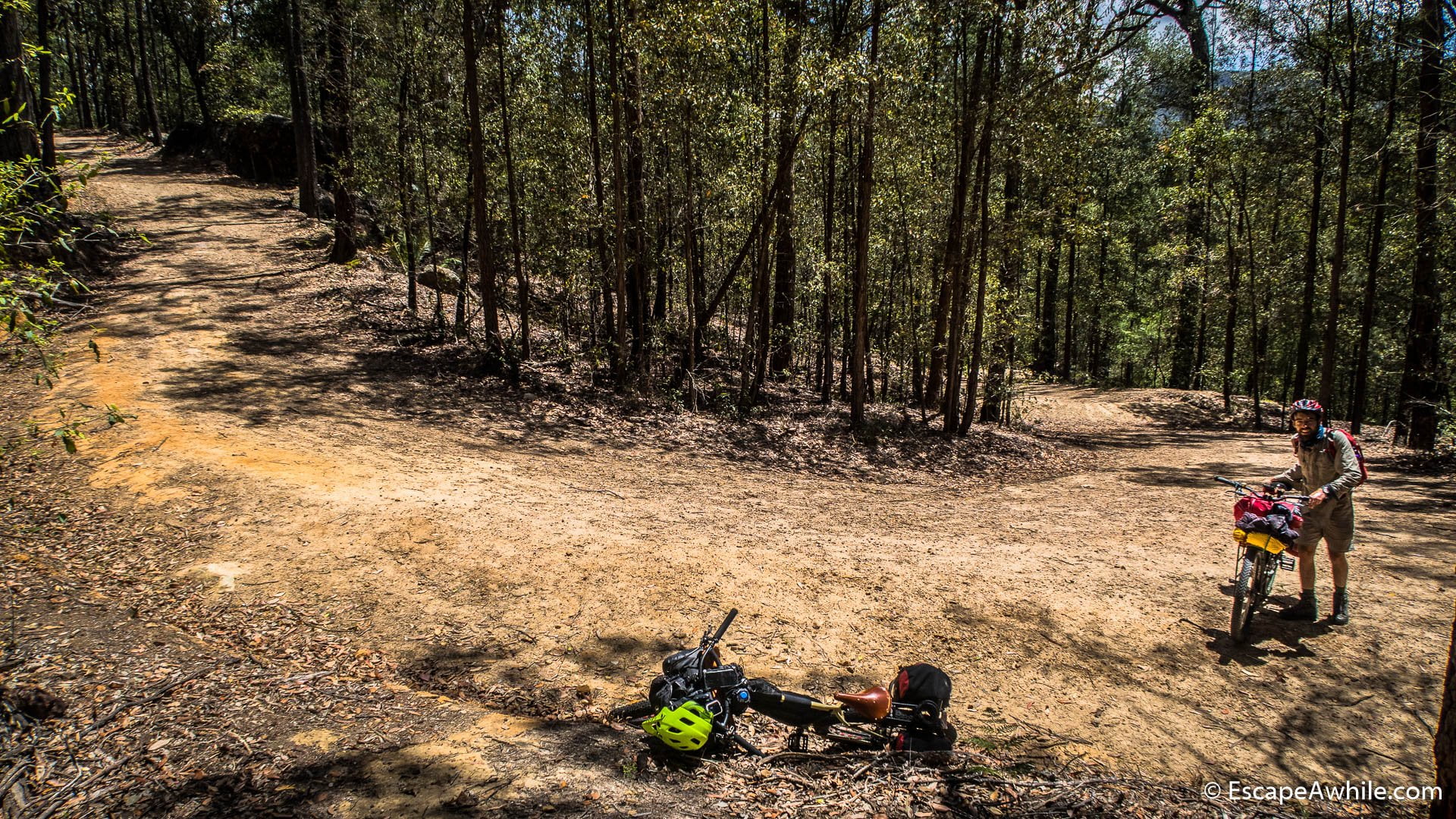
What comes down, must come up. Once we are across Yarrunga Creek, we start climbing. The trail sneaks up in a series of switchbacks similar to the other side of the valley. But there are only 250 vertical meters to climb. Did I mention we liked the ride in the reverse direction? For the hardcore or the lightweight riders – yes, the hill is eminently rideable. Just sometimes we prefer to save the pedalling muscles and stretch the walking ones. Or find pushing easier than riding up. Choose your own adventure, pick your battles.


Once
Kangaroo Valley


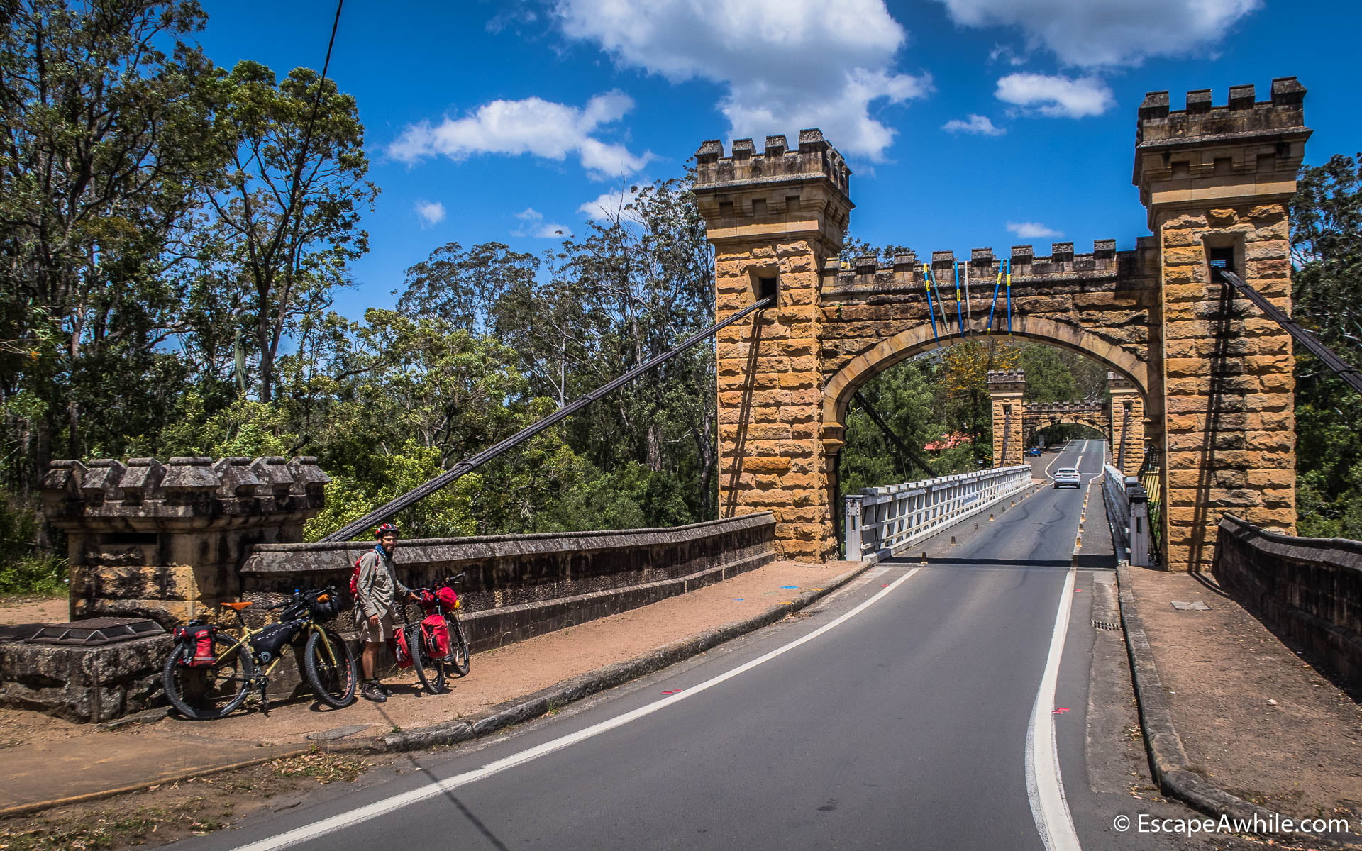
Historic Hampden Bridge is a spectacular sight at the entry to the Kangaroo Valley village. Another welcome sight is the pie and coffee shops. Once we re-fuel, the route continues out of Kangaroo Valley on another scenic back road. Most of the climb on Mt. Scanzi road is sealed, and unlike the main road in the valley, there is no car traffic.


Nice views on the top of Mt. Scanzi are followed by a wild roll down to Buggong on the dirt. Soon we merge to Illaroo Road for the final approach to Nowra. For the final five or so kilometres, as the traffic thickens, there is a convenient bike path along the side of the road, which makes the ride so much more pleasant.
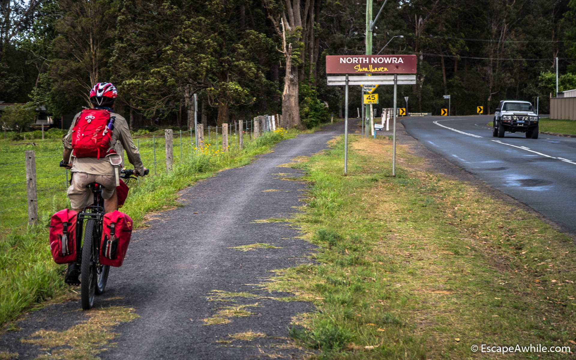
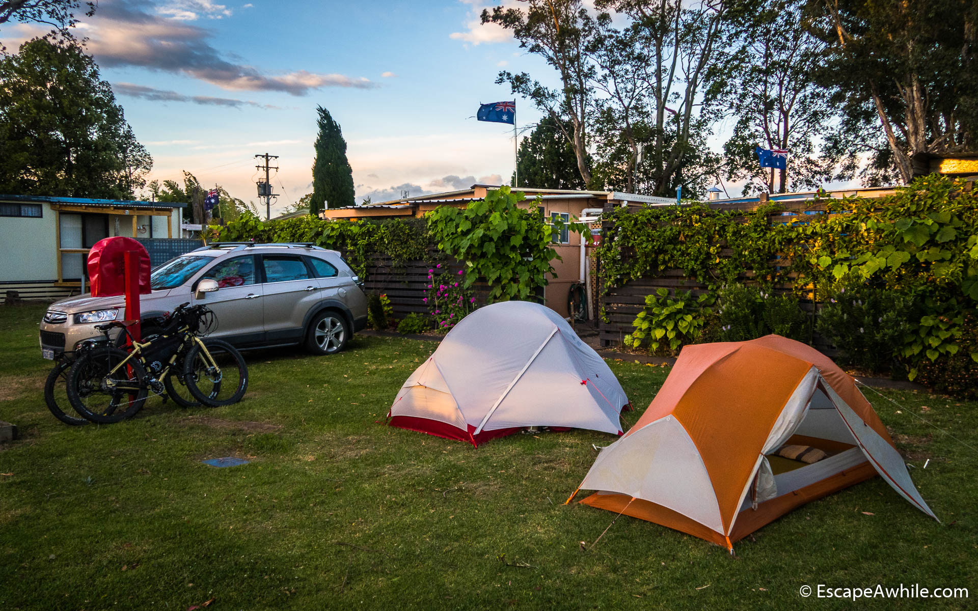
Nowra

After a day in the dry bush, Shoalhaven River is a sight to behold. We cross the mighty river on the main highway bridge and turn off to follow the bike path along the
Normally, unpowered tent sites are in the open area in front of the reception. But today the wind blows really strong. With a forecast of gusts up to 100km/hr, friendly park management people put us inside the park behind one of the screening walls. That way we have at least a bit of a windbreak and a shelter. It is hard to take a picture of the wind – but see how those flags fly perfectly stretched out?
Day 2: Nowra to Sassafras (67 km)
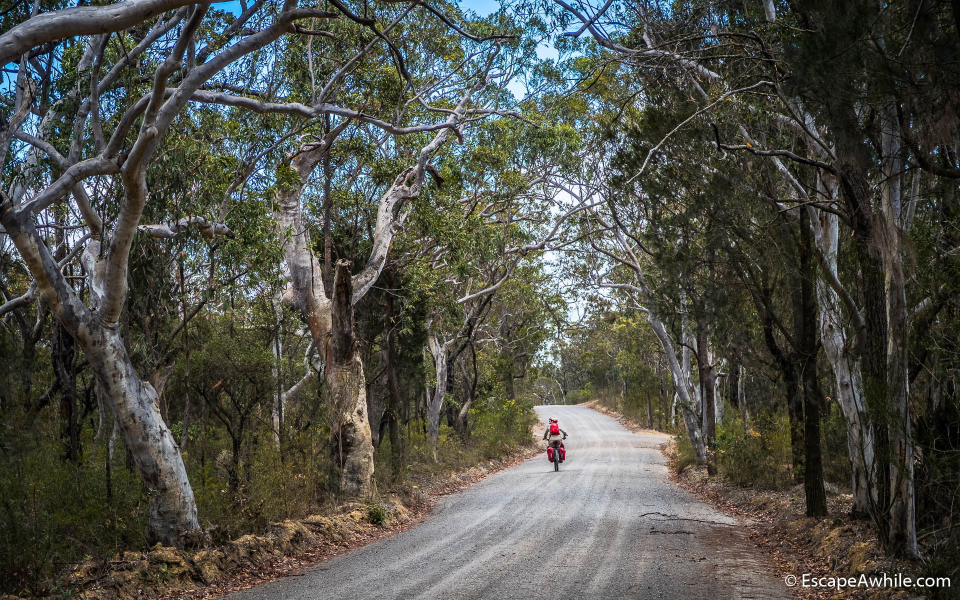
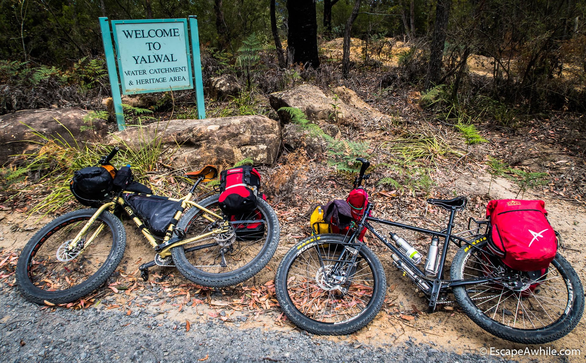
The next morning, after breakfast and an obligatory morning coffee stop in Nowra, we start riding out of town on the Yalwal road. After about 10 km, the tar gives out to the dirt, as we turn off towards the Yalwal Gap. The next 12 km are pure bliss, riding through the forest on an undulating road.
We take a break at the top of the Yalwal Gap to enjoy the views down into the valley towards the Danjera Creek dam. There is still a strong wind blowing today, bending the young trees at the lookout, but for the most part of the day, we are sheltered in the forest.
After Yalwal Gap comes the fun part – the short steep drop on a twisting road down to the dam.


Yarramumnmun fire trail
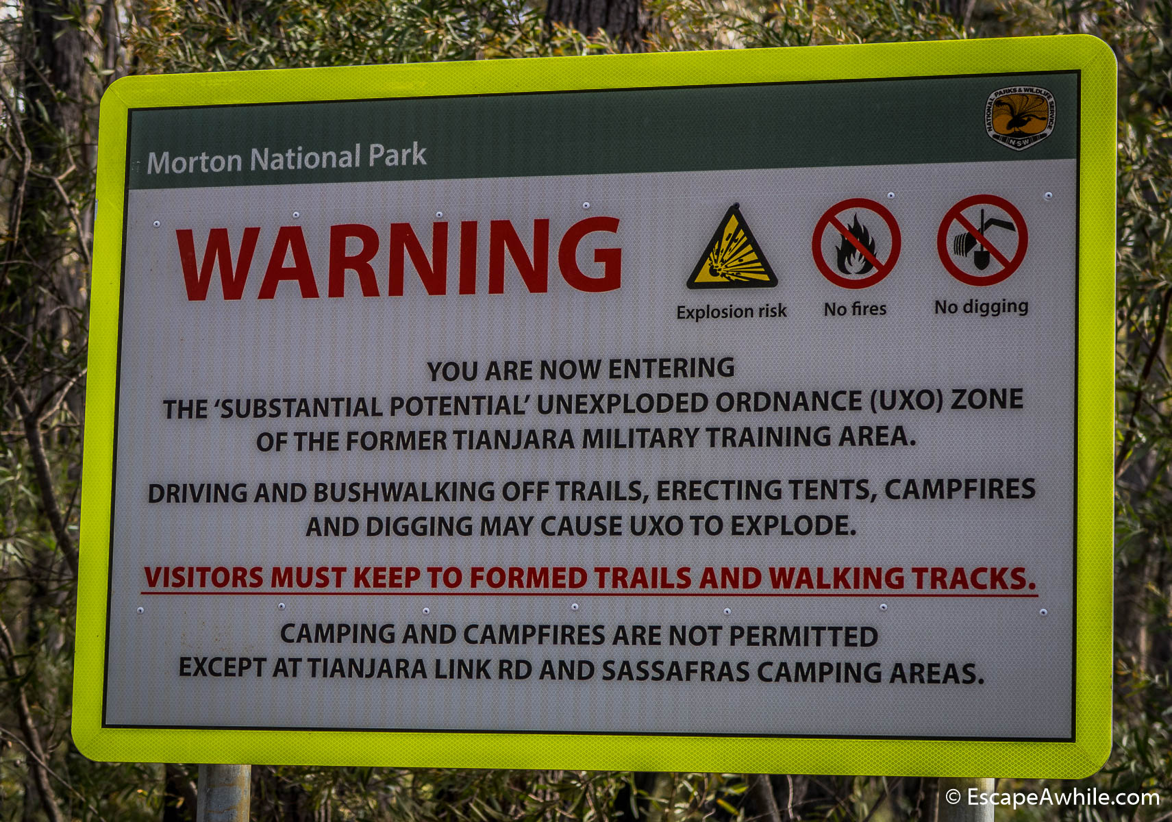
Every fun ride down must be paid for. So from the dam, we start our climb up on the Yarramumnmun fire trail. There is a locked gate shortly after the start of the trail, as we enter Morton National Park again. The climb is short (about 3km) and steep (about 300 vertical meters). This is another one of those hills we choose to push up, rather than ride.
Once we reach the locked gate, we are at the end of the climb and back on the top of Morton plateau. Following 18 km to the road is an easy ride on a relatively flat trail among blooming bushland. This is the good scenic riding we came here for.

Tianjara Falls
Once we reach Braidwood Road, we turn off left for a quick shot down the hill to Tianjara Falls. This is one of the hidden gems of the area, well worth the detour (or a stop if you are in the car travelling between Nerriga and Nowra). Unfortunately, we do not have any water running through the waterfall this time of the year.

Braidwood Road
The next part of the trip is not in any picture but is worth mentioning. It is about 7 km on the Braidwood road between Tianjara Falls and the Sassafras turn-off. The road is uphill most of the time, with a serious final climb on the last 1.5 km. That would not be too bad on the tar, except, on the open road, the 70 km headwind has finally caught up to us.
Yet the worst
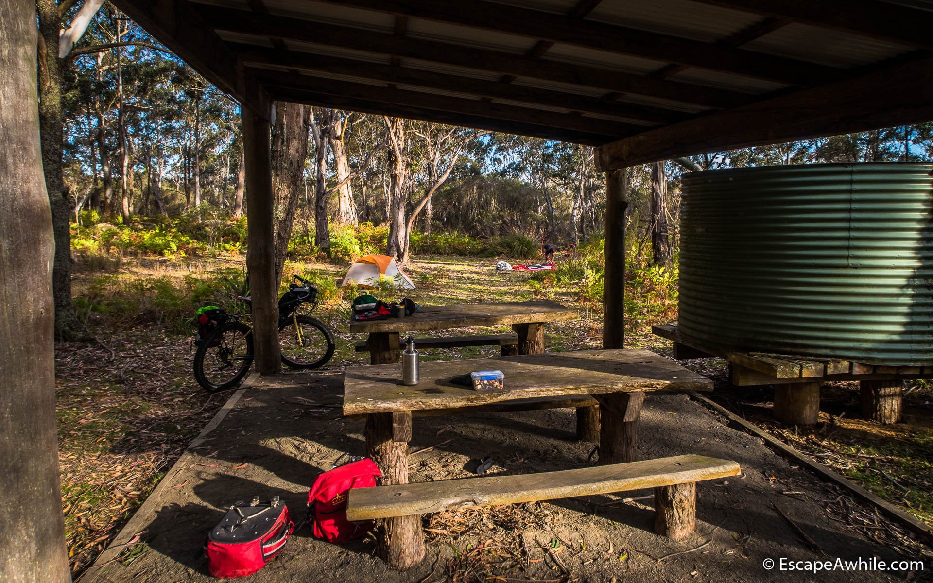
Sassafras
When we finally turn off the main road onto a sheltered side road towards Sassafras campground, we are totally exhausted. We arrive at the campground and decide that rather than continuing another 15 km into the setting sun as per the original plan, it will be better to have dinner and enjoy what arguably is the loveliest campground of the trip.

Day 3: Sassafras to Bombay Reserve (98 km)
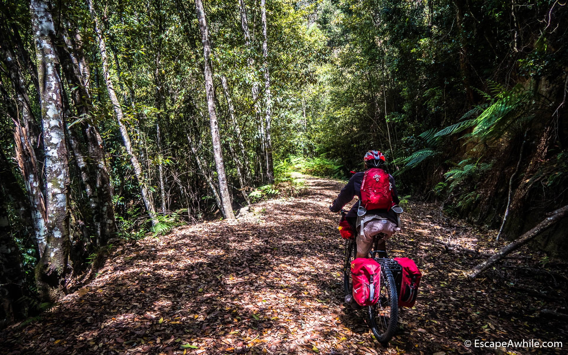
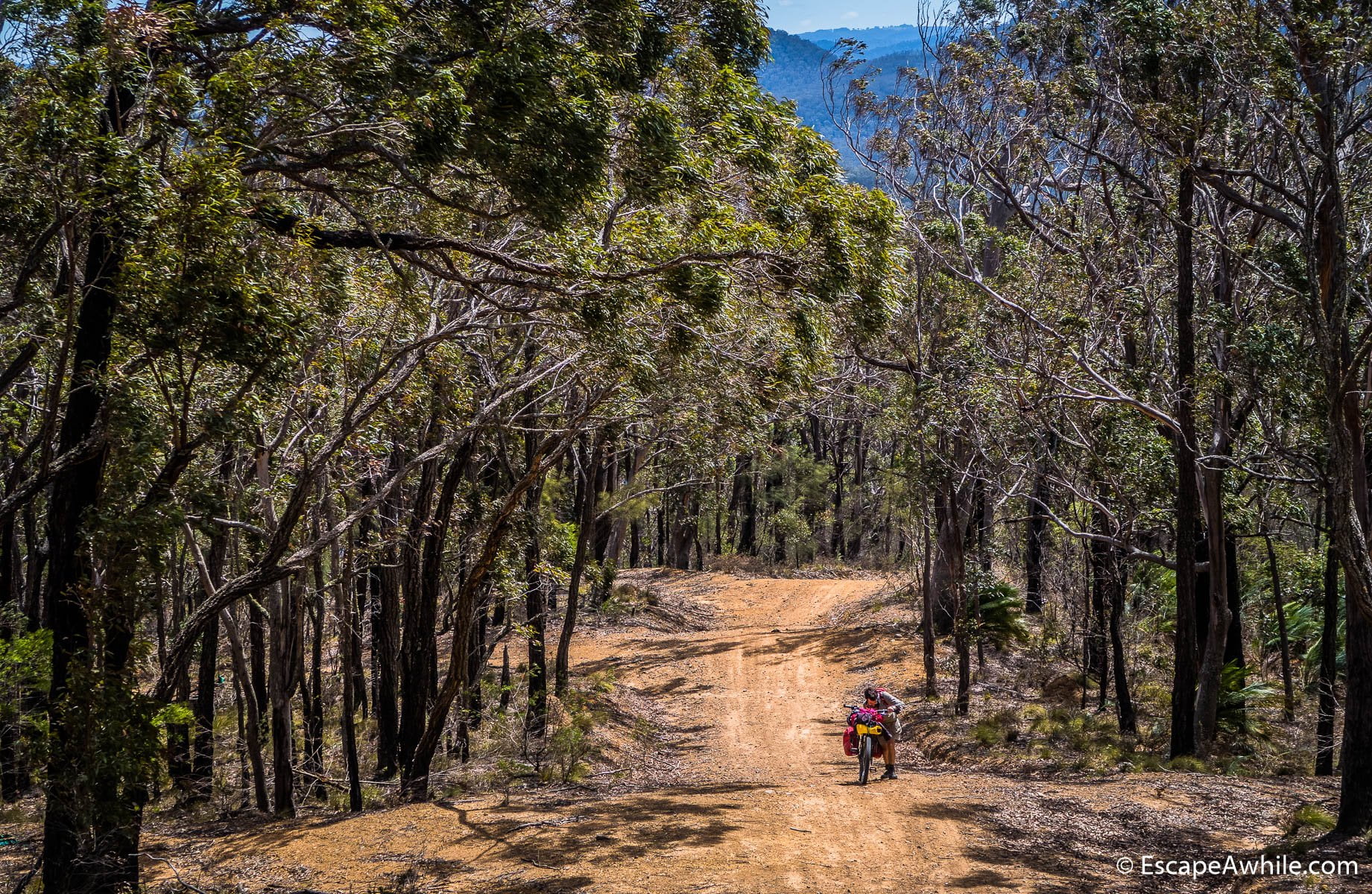
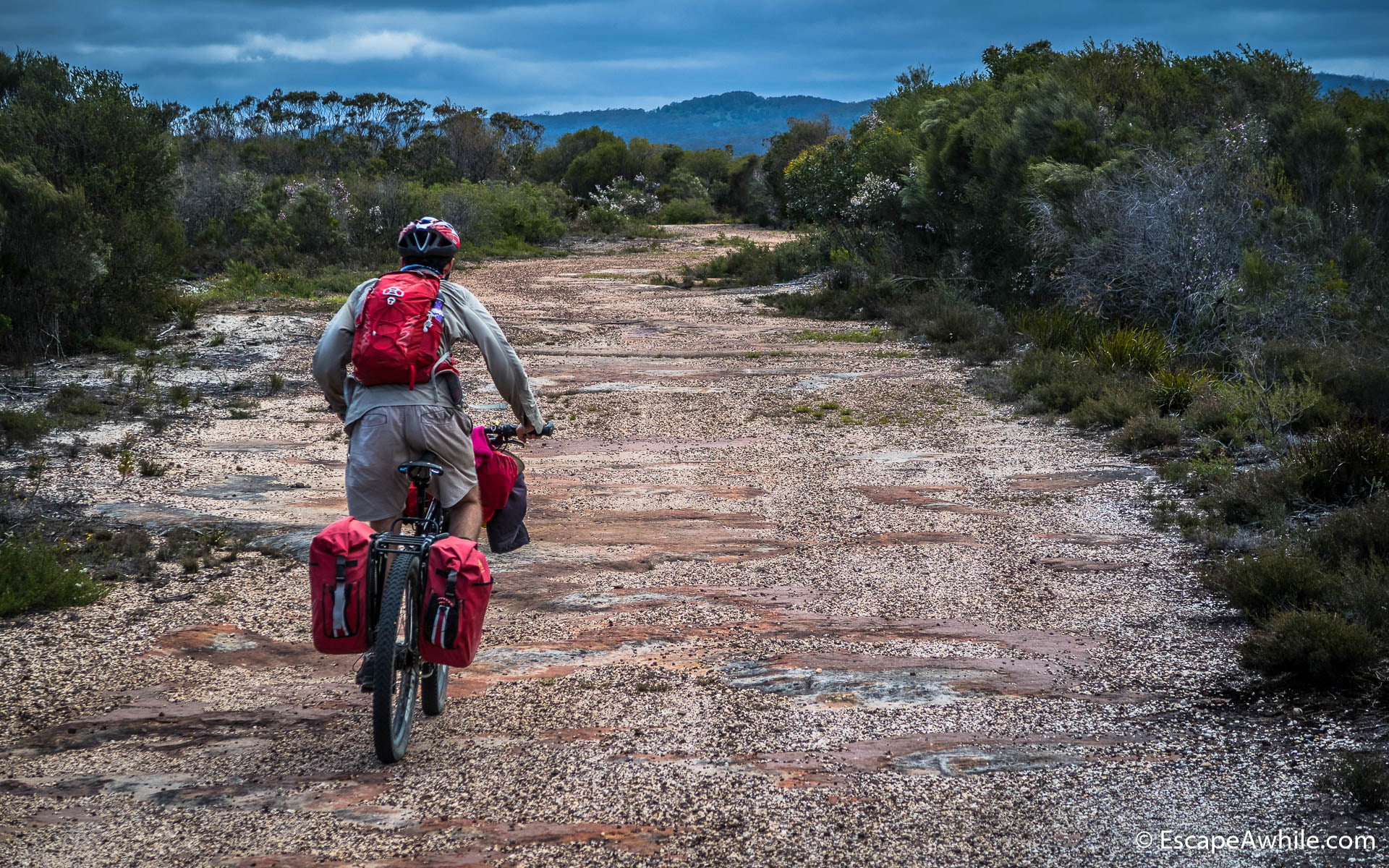
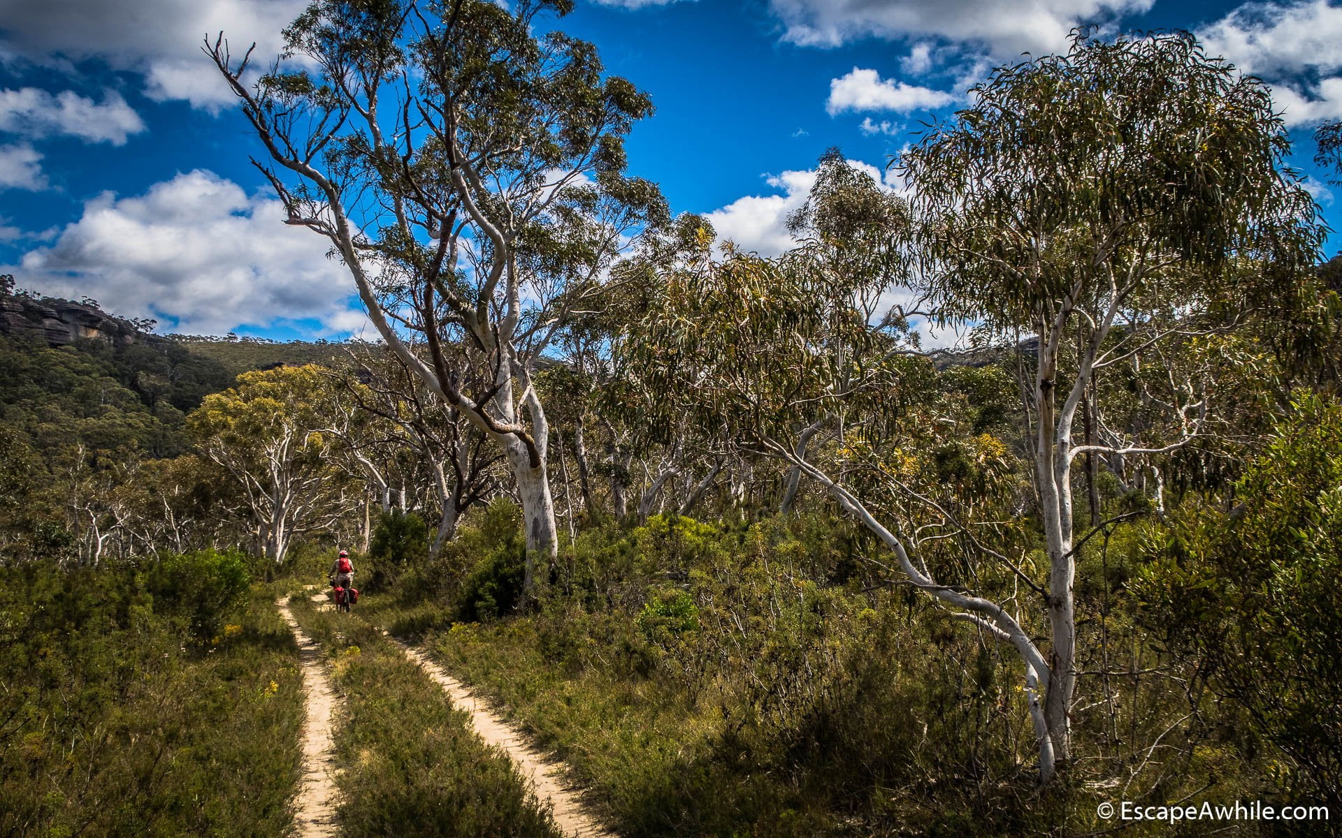
In the morning, the wind finally dies off and we are up for another beautiful day. The ride continues on the Endrick fire trail, which is an undulating easy ride through some of the most beautiful parts of the Morton National Park. Riding through the Monolith Valley protected area, the scenery changes every few kilometres – open bushland, rocky valleys, and springtime bloom.


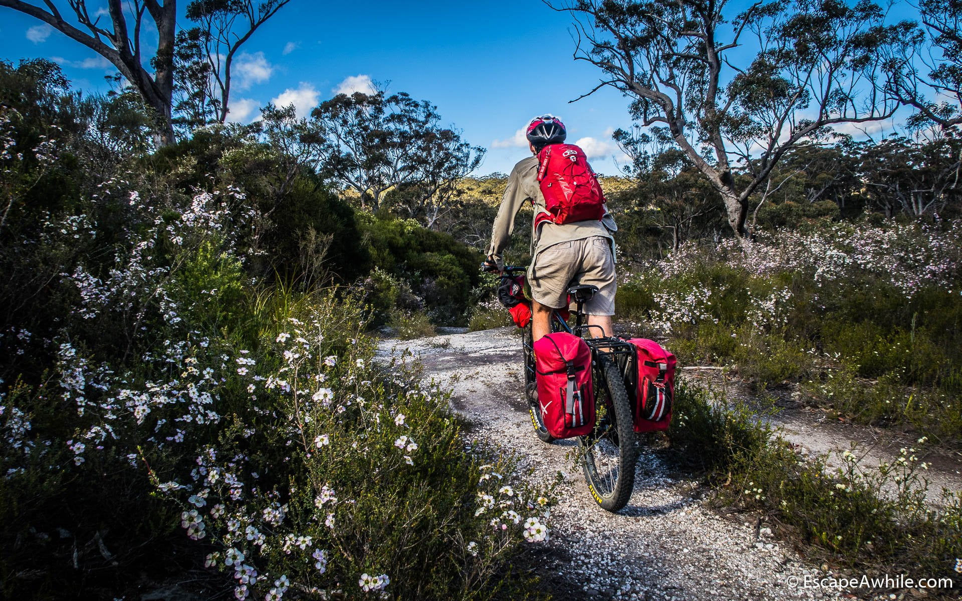
Shortly after scenic Monolith Valley, we enter what seems like an enchanted forest of Lothlorien. A bit further, we are amongst the large fern trees. Once we cross the Endrick River and turn off onto the Red Ground track, we enter the lush green forest on a mossy carpet trail.


Red Ground Track
It does not take long to realise why the route designers have decided not to follow the Endrick fire trail all the way to

The remaining few kilometres on the Red Ground track follow today’s pattern of changing scenery – sandy tracks through blooming bushland with a bit of flat rock riding thrown in for some extra fun. Once we reach and cross the Endrick River again, we are back onto the Endrick River trail and out of the national park.


Ride to Nerriga
Nice run on the gravel Meangora road takes us over the private land onto the main sealed road between Nerriga and Braidwood. As you can probably tell from the pictures and the number of superlatives I have used, the 36km stretch between the Sassafras and Nerriga Road was the highlight of the trip for us. If you are ever looking for a one-day version featuring the best of the Attack Of The Buns, this would be it.


The short stretch of the Nerriga road up to the Oallen Rd turn-off is surprisingly busy with the Saturday traffic. We are glad to be off the main Canberra to Nowra route soon. Once we hit Charley’s forest road, we are back to the blissful peacefulness of the dirt roads.

Charley’s Forrest Road
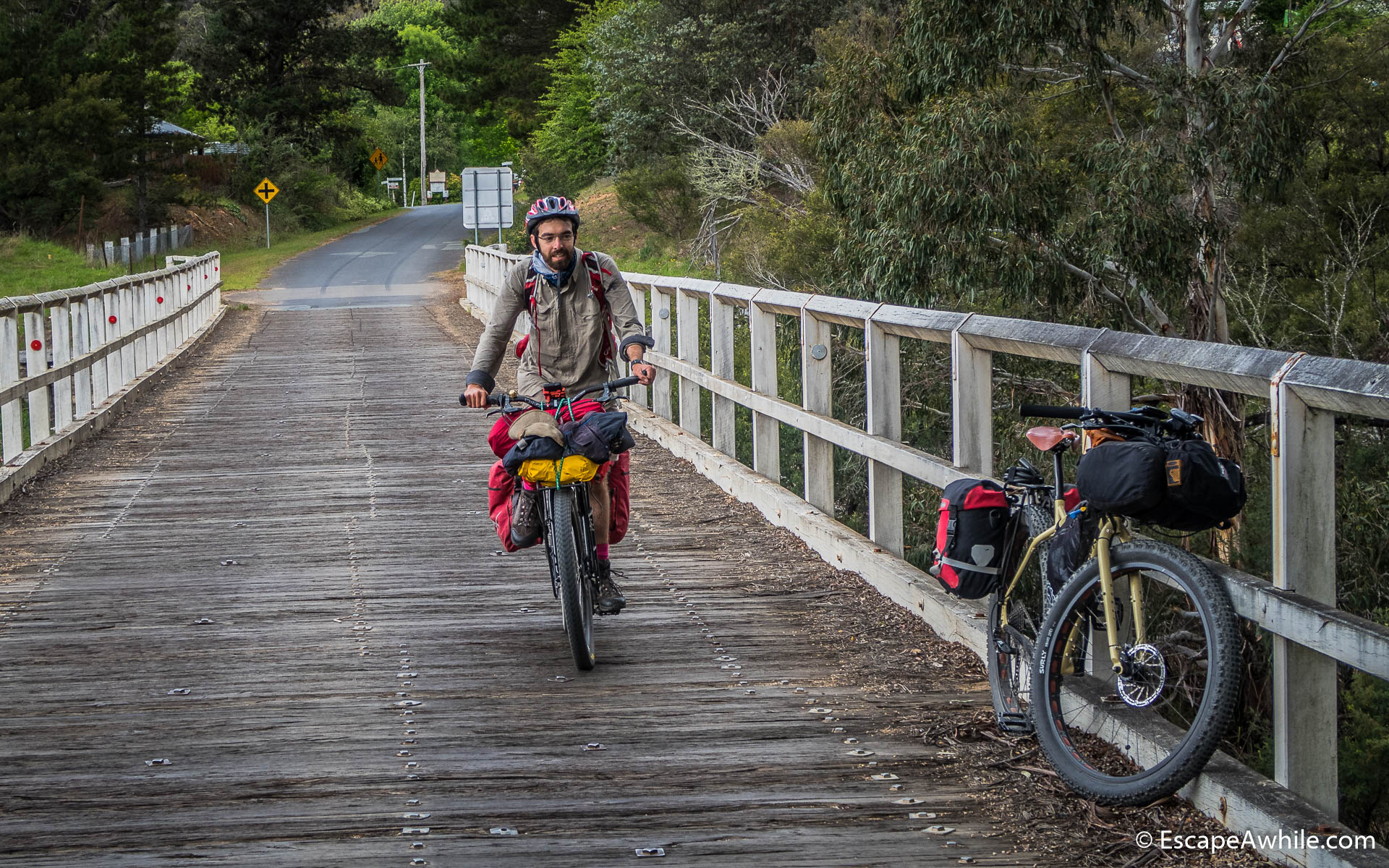
The next 30 or so kilometres are an easy roll down the well-graded dirt through the scenic bush and farmland down to Mongarlowe, with its picturesque wooden bridge.


Braidwood
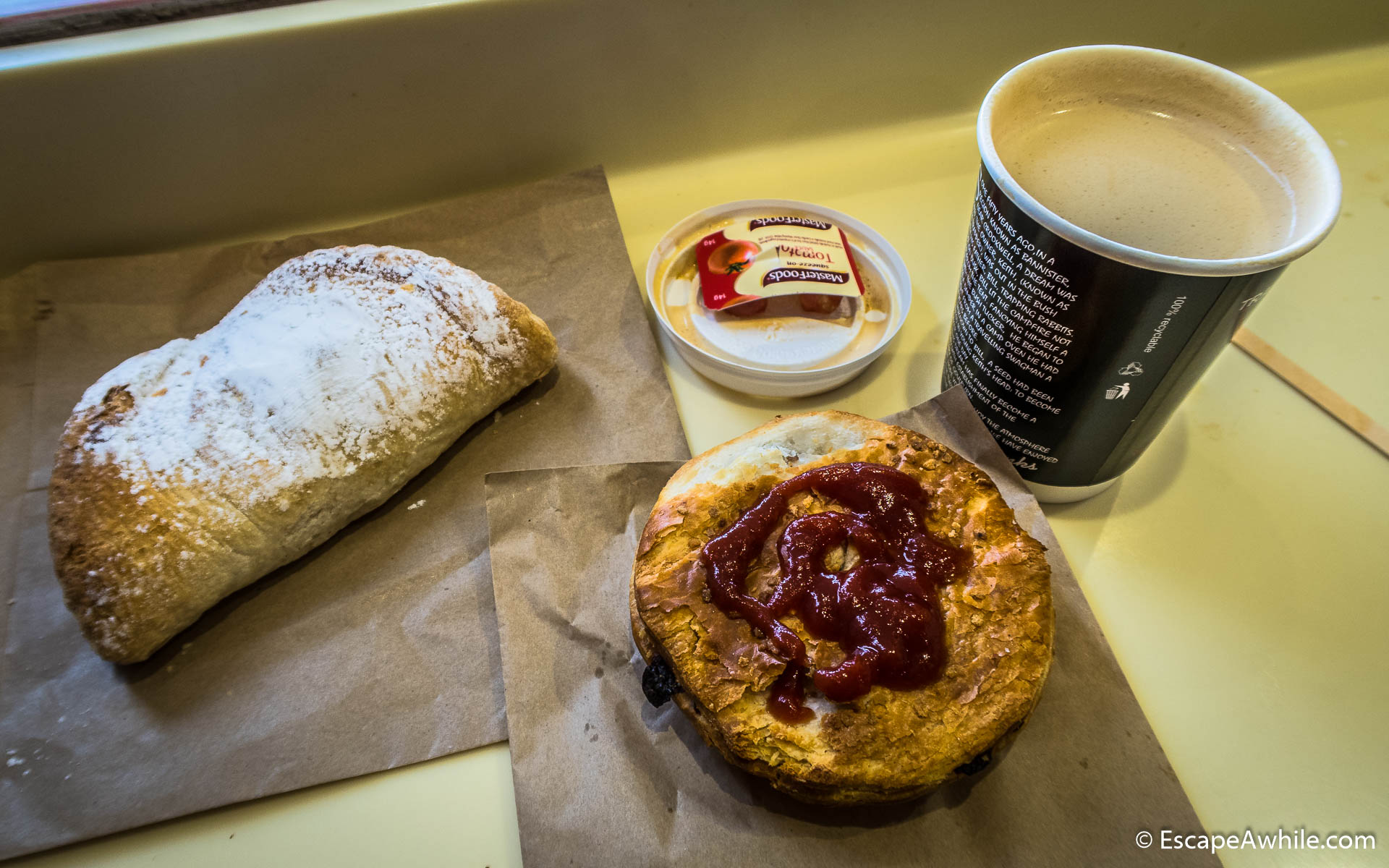
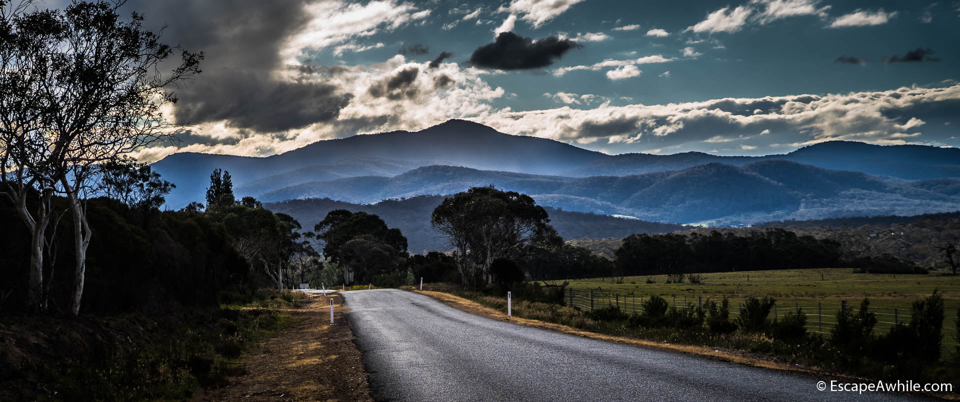
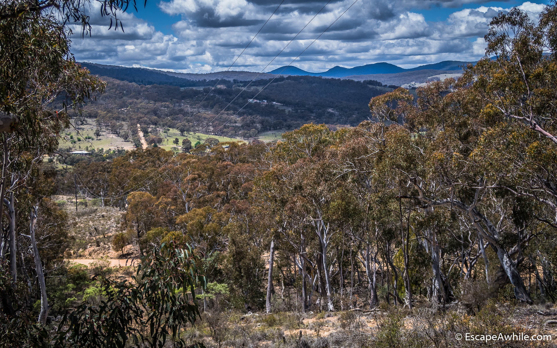
After Mongarlowe, the road is sealed and the final 15 km mostly down the hill brings us quickly to Braidwood. We arrive in the afternoon still in time for the bakery to be opened. After filling up on the treats in the bakery, we set off into the evening sun for the last 10 km ride to the Bombay Reserve campground.


There is no traffic and the low sun and dark stormy clouds make for great lighting. Despite being tired after a long day, the ride among the white gum trees with dramatic views towards the Tallaganda range is enjoyable.
Bombay Reserve
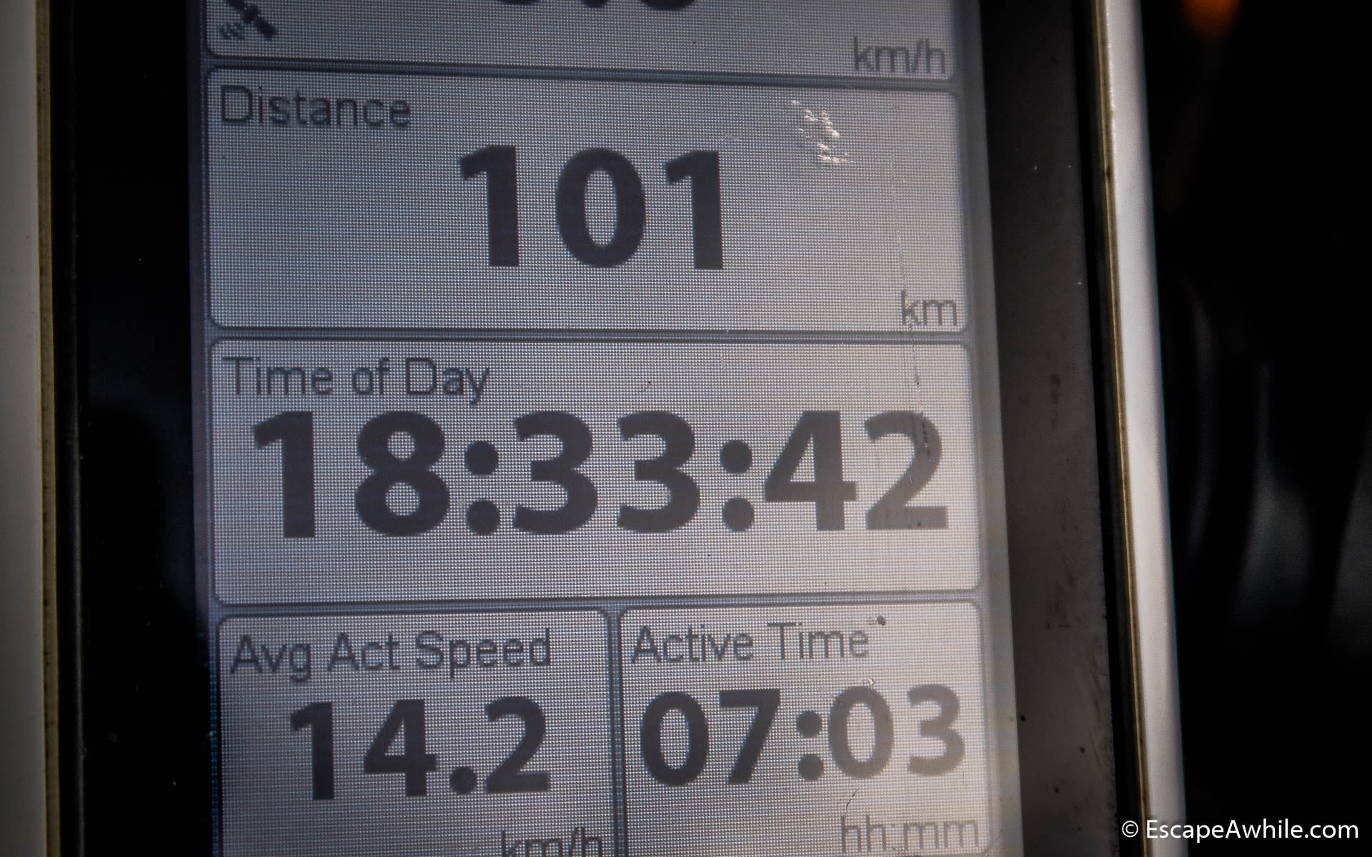
At the Bombay reserve, we take advantage of the fact that we do not have a car and find ourselves a great spot down from the parking lot, with nice views of the Shoalhaven River. After a nice swim in the river, it is bedtime. The total tally for the day is 101 km, well over our sensible touring quota. On the plus side, we are back on track with the plan.

Day 4: Bombay reserve to Bungedore (52 km)
In the morning we head from Bombay Reserve toward Tallaganda State Forrest. Sealed Little Bombay Road shortly turns into a dirt Muloon Fire trail, which gently climbs over the Tallaganda Range. There are some good views to break up the climb. And once over the saddle, we enjoy the reward for all the uphill – long lovely ride down to Forbes Creek.


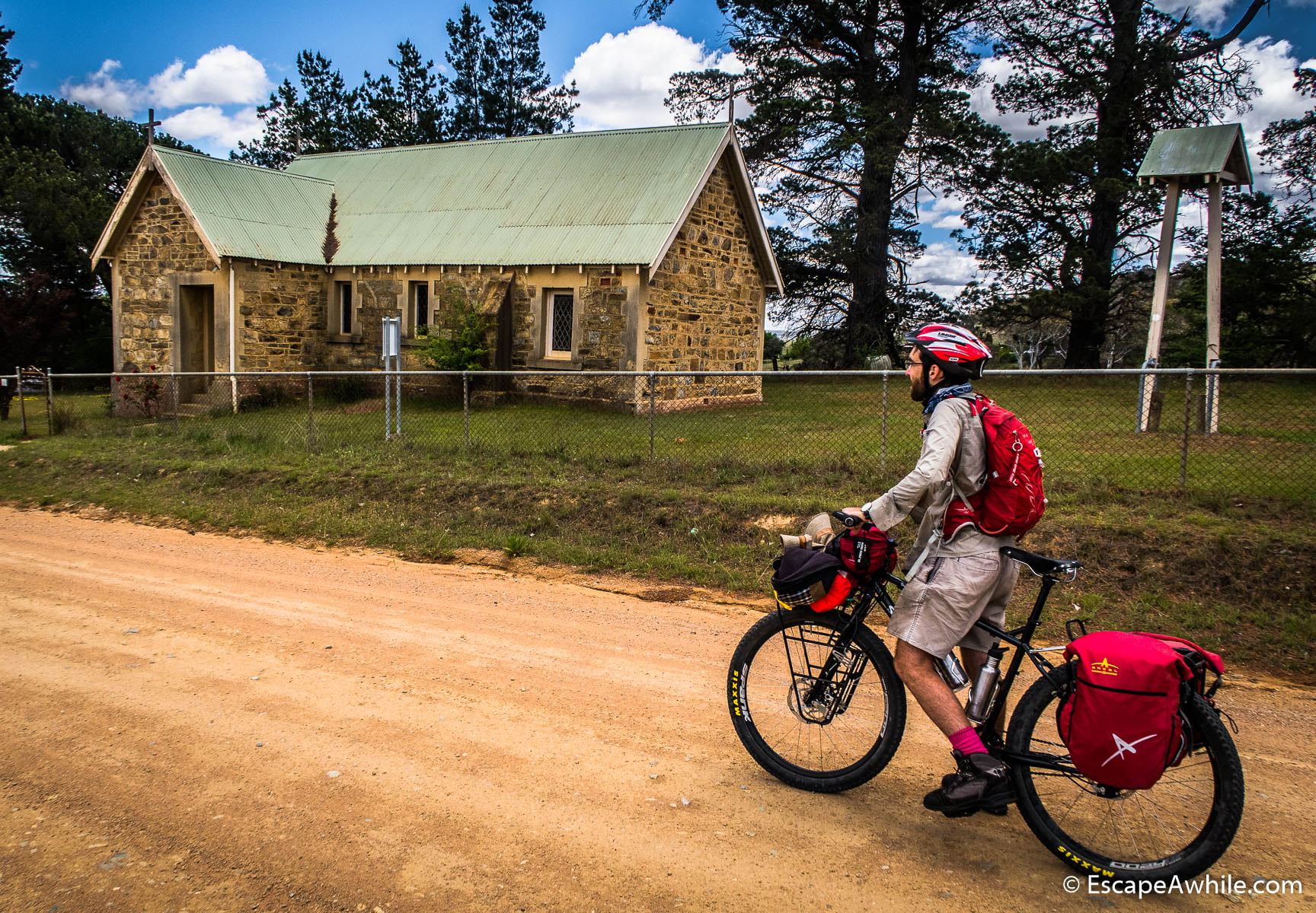
Forbes Creek is not much more than a few scattered farms, but there is a nice little stone church right next to the road. After Forbes Creek, there is again a short climb up to Hoskinstown Road. The final 20 kilometres on the Hoskinstown road are an easy ride through open farmland.
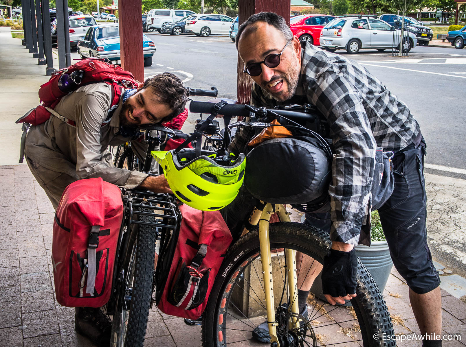
Shortly after lunch, we arrive at Bungendore, where we meet with our ride home. The hardest task in Bungendoore is to decide which of the numerous cafes to choose for the final meal and coffee to celebrate the end of a good ride.


Post ride thoughts
Wow! What an awesome trip! Let’s do it again!
But seriously: The route links some of the best scenery in this part of the world. Many parts of the route are traditionally walkers-only territory. But since the walking is mainly on fire trails, riding a bike is much more fun – despite the occasional steep hill. Considering the length of the ride, there is minimal riding on busy roads – or any sealed roads for that matter.
As said, our favourite part was the 36 km stretch from Sassafras to Nerriga road on day 3. If you are really short on time, ride this bit
The four days as described here make for fairly easy riding – a preferable option, at least for us. Originally, we planned the days with the possibility of riding from Hoskistown direct to Canberra, which would make the last day about 90km. That was also a reason for stretching day 3. Considering we ended up riding only to Bungendore anyway, the ideal split of the days would be:
Day 1: Bundanoon to Nowra – Day 2: Nowra to Sassafras – Day 3: Sassafras to Wog Wog Campground – Day 4: Wog Wog to Bungendore.
That said, ending day 3 with a dinner at Braidwood bakery followed by a swim in Shoalhaven River at Bombay Reserve rather than staying in the bush at the Wog Wog was a (hard-earned) treat.
Fast facts
| What: | A four-day |
| Length: | 320 km from Bundanoon to Bungendore, with a 4.7 km vertical climb + drip thrown in for some exercise |
| Time: | 3-4 days. The four-day version described here is a bit more relaxed. Add an extra day or two if you have never been in this area to relax and explore. A day extra for a canoe trip on the Shoalhaven River from Kangaroo Valley would break the time in the saddle nicely. |
| Route: | Official route description at Bikepacking.com: http://www.bikepacking.com/routes/attack-of-the-buns/ Alternative GPX track download, marked with campsites and other points of interest available at https://ridewithgps.com/routes/25525997 |
Practical tips
Transporting bikes on the train
Both ends of the ride are served by the NSW Train
The only downside of that sweet deal is that you need to arrive at
Book well ahead, as there is a limit of 3 bikes per regional train. Finally, bike bookings
Weather and when to go
This is Australia. Pushing the bike up some steep hill in the middle of the summer, when temperatures are 35-40+ °C is not going to be fun. Plan your trip for the cooler parts of the year – that is March to November.
On the opposite extreme, parts of the Morton National Park are over 1000 meters high. Particularly if you plan to spend the night at Sasafrass campground, it could get pretty cold there anytime. In the middle of the winter (June-August), plan for a sub-zero temperature at night.
Water
Common sense if you are used to the Australian bush, but warning if you are not: if riding after a dry summer, be prepared and carry enough water – the creeks and rain tanks at campsites might be dry.
That said, every day you will visit some town or ride over a major river – so there should be no need to carry water for more than a day. Treat any water found.
Camping
The camping tab at the route description has a good overview of the campsites, no need to repeat it here.
Our favourite campsite was at Sassafras since we had the campsite for ourselves. After a long day in the saddle, swimming in the Shoalhaven River at Bombay Reserve near Braidwood is also hard to beat. Griffins Farm at the bottom of the valley on our day 1 also looked promising and would be my choice for the last camp going the other way round.
Thanks for your trip notes. We are yet to adventure into camping on our tour bike riding, opting for bnbs, pubs, cabins in caravan parks or motels. Could the trip be adapted to finish each day in a town with accommodation.
Also like your thinking of the reverse direction
Linda, thanks for stopping by. The “no camping” option should be doable on most days. There is usually a town not far from where we camped. There are definitely accommodation options in Bundanoon (day 0), Nowra (day 1), Kangaroo Valley (if you decide to stop there for the night), Braidwood (day 3) and Bungendore (the end). The only place where there is nothing convenient on the trail would be around Sassafrass.
The nearest accommodation I could find on google maps is Corang River Bed & Breakfast on the Nerriga Road. That is kind of past the Monolith Valley and would make the day from Nowra to be around 120 km. Not sure whether that is doable for you or not, but assuming you travel lightly without the camping gear, that might be an option.
Thanks so much for the tip for the day trip from Sassafras to Nerriga for those short on time! We did it today, leaving the car at Sassafras campground carpark. It was an amazing section of track and coupled with a beautiful swim in the Endrick River. We had to take a bit of care on the road back from Nerriga to Sassafras as the shoulder is narrow, but all fine.
Great write up. Thank you.
Did you purchase and carry topo maps? Or did you follow a GPS file ? I have my worked out how to do the gps thing -hoping to buy the right maps? Any help here appreciated.
Hi, Liz, thanks, glad you enjoyed the story. Navigation: We just followed the GPX track downloaded from the Ride with GPS website (link in fast facts). I used OsmAnd (Open Street Maps for Android) application on my phone instead of paper maps for this ride. The same app is available for iPhone as well, I believe, and the basic maps are free (you pay small extra for contours). James just recently bought an eTrex 30 GPS – it has a quite impressive battery life (25 hrs on paper / tested to last two and a half days riding), but the screen is fairly small. I prefer the phone when navigating from electronic maps due to the decent screen size – you can see more area should you need to re-route.
Great article! Did you need to carry food?
Hi Terry, that is an intriguing question. We definitely did carry food, and while we stopped for breakfast or a treat in a few places, we had most meals from our own supplies. Answer to whether you can only use pubs/cafes along the way is similar to the “no camping” question asked by Linda above. There are fairly long stretches through the bush – whether you can do those without food depends on how much you need to eat and how fast you travel. I would definitely be taking at least some snacks – there is nothing worse than running out of energy halfway up the massive hike-a-bike hill with another 40km to ride to a pub that has just closed pub.
Hi Miro, thank you for writing up your journey, something that we all can learn from and get the inspiration.
I want to test my fitness before I do all in 4 days.
You mentioned that your favourite part was “36 km stretch from Sassafras to Nowra road on day 3”. I am a bit confused as your Day-3 is between the Sassafras to Bombay Reserve.
Looking at the pictures, I think the Sassafras to Bombay Reserve is the highlight. Would you please confirm this?
Hey, Hadi, the highlight was day three, Sassafras to Nerriga road (not Nowra, my typo, or mix up of the names). I have updated the text, thanks for pointing that out.
Thanks for sharing your trip. We did it the opposite way in late May 2023. Awesome trip, just as you posted. The campsites were a highlight, so best to take a tent, there are some hard days and a night in the tent before tackling those steel climbs was a relief. Scenery along the whole route was spectacular. Well worth the effort.
Great write up and information, thank you for taking to time to put it all together and post it. I’m gunna do it soon with bunch of friends. I’m familiar with some of it and can’t wait to go back to the bits I’ve done before, and experience the bits I haven’t been to yet. Happy trails !